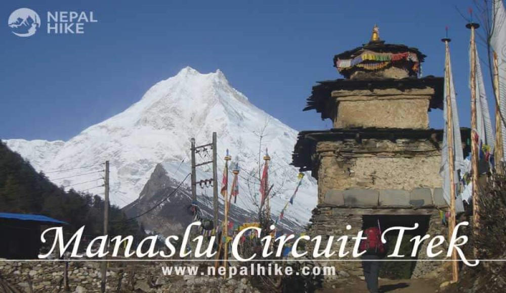
Manaslu Circuit Trek

10 reviews

Highlights

  • Restricted area Trip.
  • Recently Open Tea House Trek
  • Nearby Tibet Border
  • A unique culture and live hood.
  • Amazing Mountain scenery including Mt. Manaslu.
  • Cross over Larkya Pass (5,160m).
  • Comparatively affordable price.
  • Two Conservation Areas in one trek.

What is Manaslu Circuit Trek all about?

The Manaslu Circuit Trek is a trekking route that circles Mount Manaslu, the eighth-highest mountain in the world and crosses through the Larke La pass. This trek is all about discovering other cultures, lifestyles, languages, foods, daring adventures, breathtaking natural scenery, and making a ton of wonderful memories.

Manaslu Circuit is not only about a thrilling adventure between mighty mountains. Moreover, the trek features cultural and religious values too. This trek is a golden opportunity to experience distinctive Tibetan culture and tradition.

Not only that, the trip takes from developed cities to the rural areas of Nepal. From the lowlands of Arughat to the soaring height of Larke La (5,160). Also, it provides chances to visit multiple Buddhist monasteries as well as Hindu temples. 

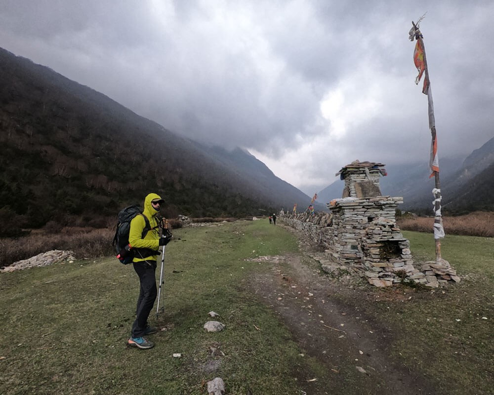
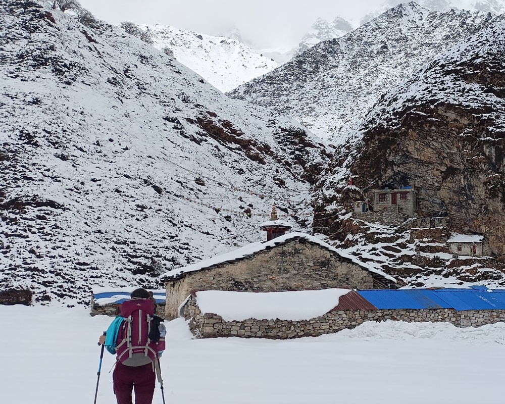
The people of Manaslu are enriched by art, culture, and religion. On most of the trail, you can see the Mane wall with a Buddhist Mantra, attractive Chorten, an ancient monastery, and other Buddhist religious landmarks, which make your soul holy. It is prohibited to fish and hunt on this holy site.

How beautiful is Manaslu Circuit Trek?

The majority of people believe Manaslu is an alternative to Everest and the Annapurna regions. However, we believe that Manaslu is a unique Himalayan realm with a lot to offer. Neither Everest nor Annapurna can match its unique beauty and values.
There are reasons for being a restricted area. You will find it when you visit Manaslu.
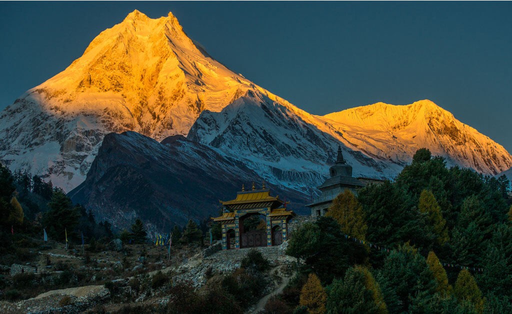
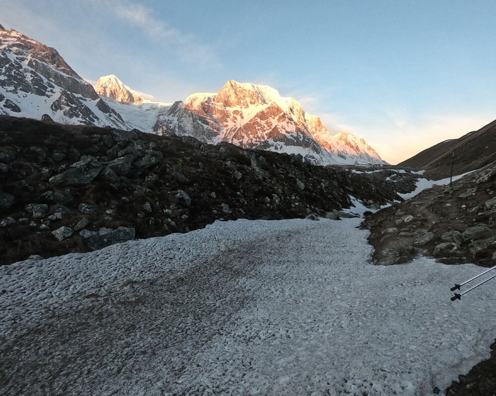
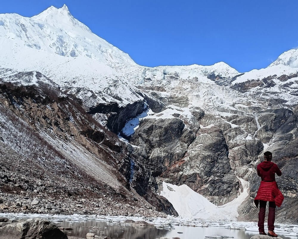
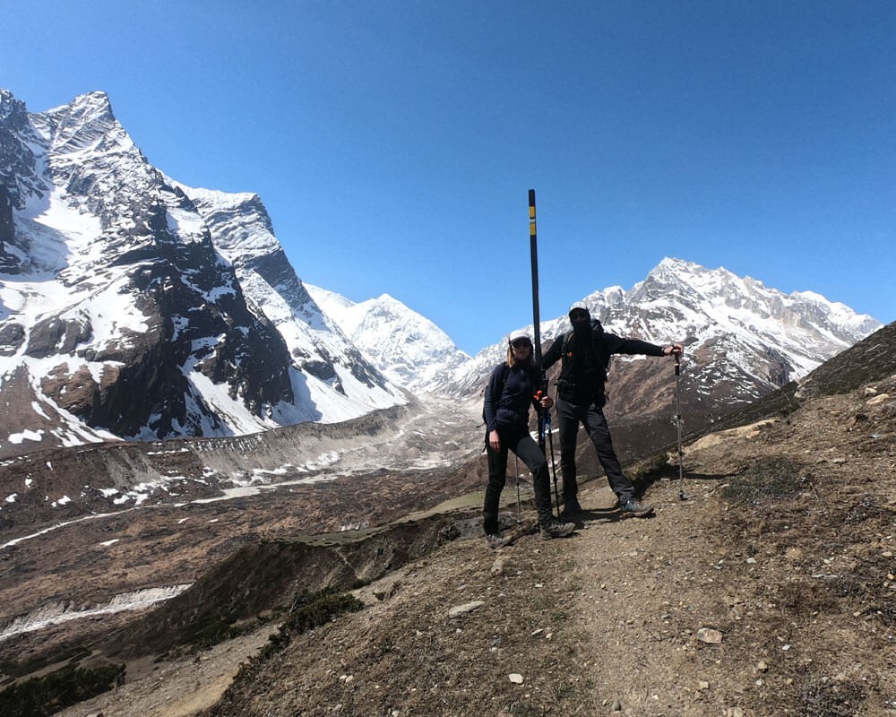
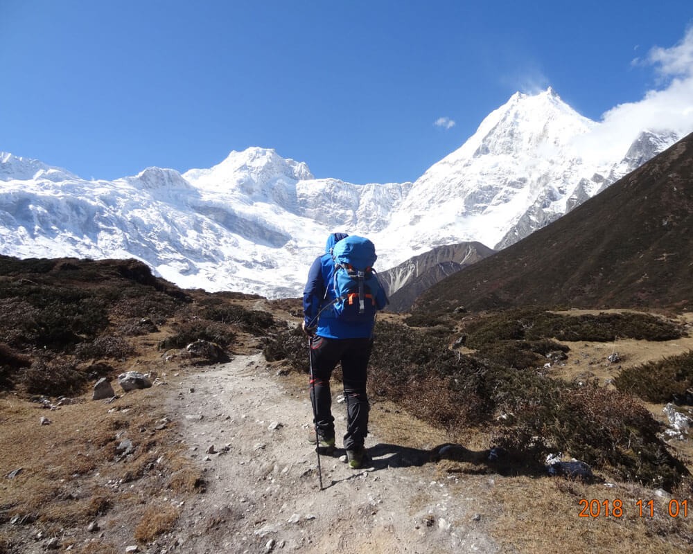
The view of Manaslu (8,163m) is amazing during sunset and rise, and other peaks; Some 7 thousand like Himalchuli, Ngadi Chuli, Shringi, Annapurna II, Lamjung Himal, Ganesh Himal, along with some 6 thousand like Langpo, Saula, Buddha Himal, Samdo peak makes your trip unforgettable.

The Manaslu Circuit Trek blends adventure, a rich culture, and beautiful alpine scenery. The Manaslu trek is growing in popularity because of its unspoiled beauty, distinct culture, tradition, heritage, and way of life.

Let's talk about the route of Manaslu Circuit’s trail:

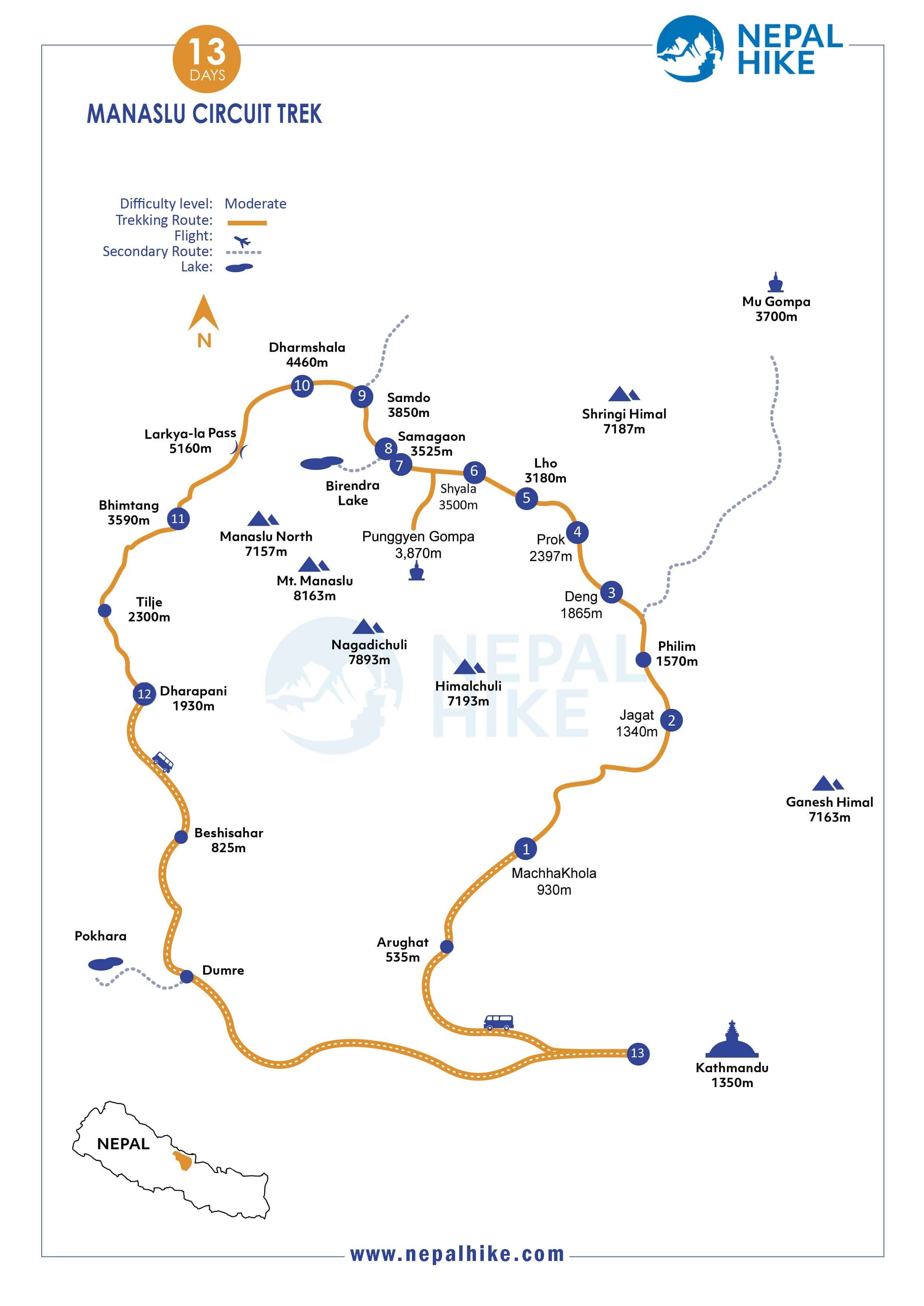
The recently opened Manaslu Teahouse Trek starts at Sotikhola or Machhakhola after driving from Kathmandu (changing bus in Arughat) and ends at Dharapani crossing over the Larkya La Pass (5,160m).

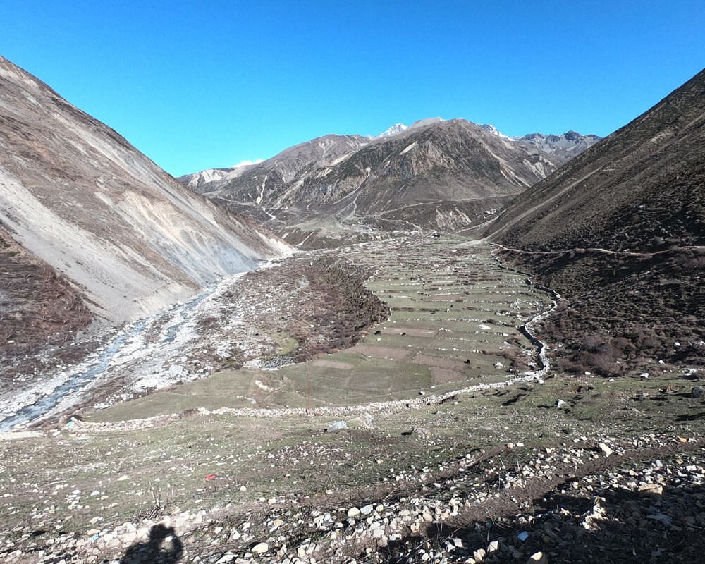
The trail follows an ancient salt trading route through the Budhi Gandaki river bank and jungle with lower villages such as; Machhakhola, Jagat, Philim, and Rana. Those villages are mostly inhabited by the Gurung ethnic.

The trail follows the riverbank making a deep gorge and spectacular view of mountains to higher villages Namrung, Lho, Samagaun, Samdo, Dharamshala, and Bhimtang via Larkya Pass. As Manaslu has recently opened to tea house trekking, there are many places that just a few trekkers have visited yet.

After Larkya La, the place will be different from the Manaslu region. Even though you will only be there for a few days, you can still come in touch with nature. The trail passes through some villages like Bhimtang, Goa, Tilje, and Dharapani.

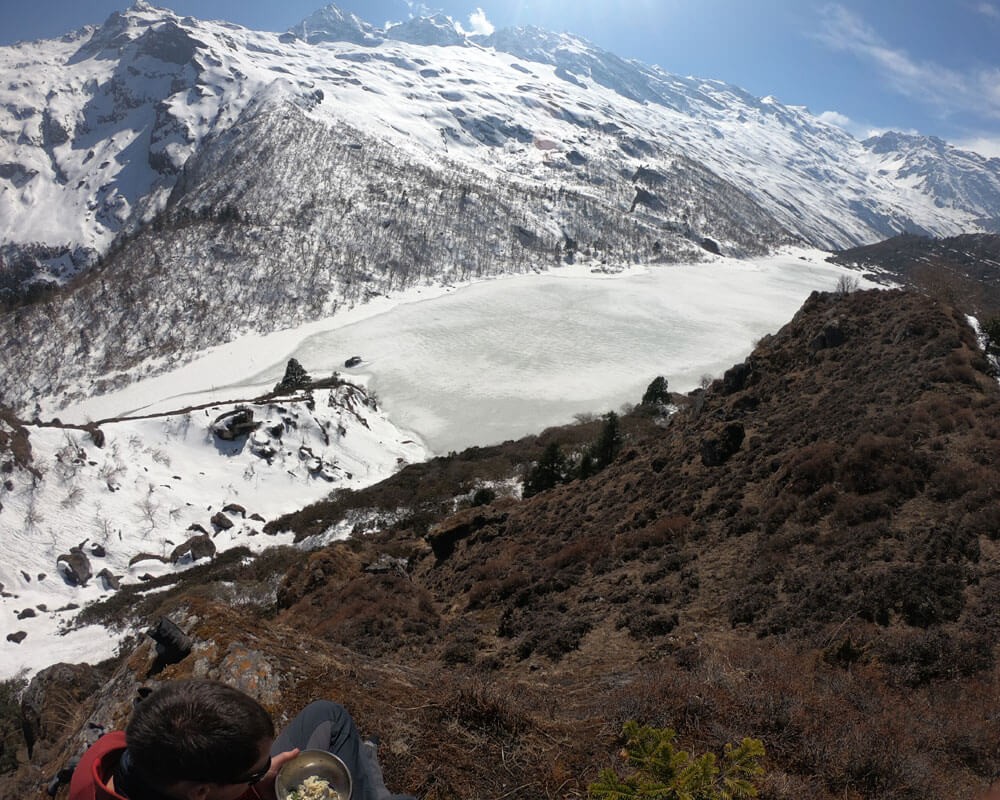
To make your trip different from other trekkers, Nepal Hike is always concerned with exploring new places for a day hike side trip. It is an incredible day hike to the Kal Tal (Kalchhuman Lake) from Prok Village, visit Hinung Gumba from Lihi, and explore the Tibet border at Ruila La Pass at an elevation of 4,998 meters from Samdo village.

All required permits for Manaslu Circuit Trek. Cost details

Manaslu is listed as a restricted area of Nepal. That means, it requires special permits which can be obtained by registered travel companies only. Also, permits for conservation areas are needed to trek inside Manaslu.

The first permit is the Manaslu Restricted Area Permit (MRAP), which is obtained from the Department of Immigration. The price is different according to month; From September to November per week is $70 and $10 per day for additional days, and From December to August per week is $50 and $7 per day for additional days.

Likewise, the Manaslu trek requires permits from the Annapurna Conservation Area (ACA) and Manaslu Conservation Area (MCA). They cost $30 for each and $10 for the SAARC countries.

Manaslu Circuit Trek Duration and Coverage

Manaslu Circuit Trek can take a minimum of 11 days to 20 days. Our 13 days will be best to explore most of the attractions around Manaslu. The duration depends on the side trips, acclimatization days, and rest days. Also, arrival and departure plus preparation day can add more days to the itinerary.

The Manaslu Circuit Trekking route is spread over 177 kilometers (110 miles) from the remote northern part of Nepal to the Tibet border, gaining a maximum elevation of 5160 meters (16929 feet) at the top of the Larke La Pass. However, if you would like to explore the hidden Tsum Valley and Manaslu side trip, the trek can extend for 18 Days also, known as Manaslu Tsum Trek.

Transportation in Manaslu Circuit Trek

Manaslu is accessible only by road. There are multiple public buses that leave in the morning from New Buspark, Kathmandu to Arughat. After reaching Arughat, you have to change to another bus to drive to Soti Khola or Machha Khola.

While returning, jeep services are available from Dharapani. Those jeeps are only up to Besisahar. After Besisahar, there will be plenty of microbuses that go to Kathmandu.

Instead of public buses, you can hire private vehicles like Jeeps and SUVs. It can directly take you to your destination. It will be quicker and easier in comparison to public buses. But, it will be costly.

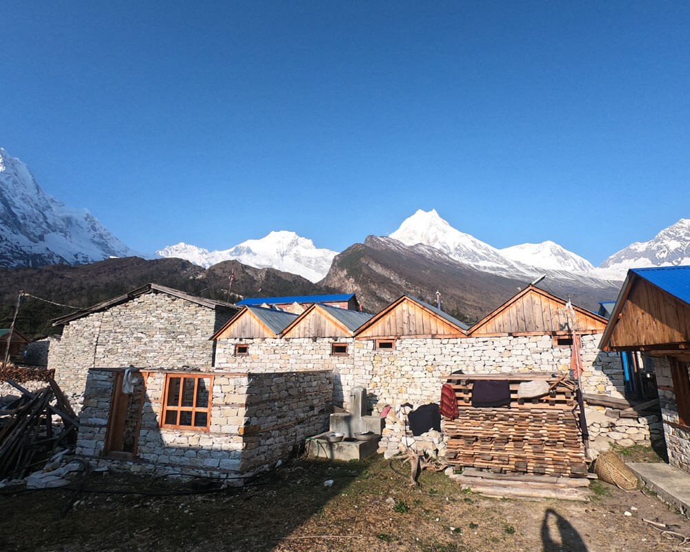
Accommodation during the Manaslu Circuit Trek

As the Manaslu trek is a tea house basis trek, the accommodation during the trek is Tea Houses. Tea houses are commonly used for food and overnight stays.

The tea house is a basic accommodation in the Himalayas that provides room and food services. Nowadays, they are providing other services like Wi-Fi, cold and hot showers, and other facilities too.

You can find some standard lodges in lower towns. They are made up of concrete and are usually bigger than tea houses. Also, it has more room availability and more services than tea houses.

Food in Manaslu Circuit Trek

Usually, every tea house provides food service too. Breakfast and dinner will be served at the same tea house. But, for lunch, sometimes it can be on the way while trekking. Talking about the menu, tea houses have unexpected menus. They serve a wide variety of foods including Nepali, Tibetan, and some continental foods too. You can choose wisely and have your favorite treat. But don’t expect fancy foods like in Kathmandu.  Along with food they also have beverages too. From multiple hot drinks to cold drinks. They also have alcoholic beverages too.

Weather in Manaslu Circuit Trek

The weather in the Manaslu region differs according to the elevation. The higher part is always cold. Whereas the lower part depends upon the season. It is warm in summer and freezing in winter. 

Also, the region has rainfall during the monsoon season. Similarly, snow covers most of the parts during the winter. But in spring and autumn, the weather is more pleasant and the visibility is really clear. 

Best time to travel to Manaslu Circuit

All of Nepal's seasons have an impact on the Manaslu region. Which makes spring and autumn the ideal seasons to trek the Manaslu circuit.
Especially in autumn(mid-September to mid-December), it is pinned as the best. The Nepal Government also charges extra dollars for the permit this season. In terms of the spring season, it is also best with flowers blooming. But, you might get some snow on the trail and face light rains. 

Trekking Gears for Manaslu Circuit Trek

There are a bunch of things you should carry for the Manaslu trek. You have to carry clothing that is suitable for trekking. Also, some gears are required for some challenges on the trail.

Some of the gear and equipment are hiking bags, trekking poles, down jackets, sleeping bags, microspikes, hiking boots, and many more. There are still lots to mention on the list, check the packing list for Nepal for more details. 

Manaslu Circuit Trek Map

The map of the Manaslu Circuit Trek indicates the route we'll be traveling. It displays the location of our accommodations. It is also helpful to locate various locations like monasteries, passes, base camps, and many more. The Manaslu Circuit map is available under the section on trip maps.

Brief itinerary of Manaslu Circuit trekking

Here is our outline itinerary of the Manaslu Circuit trek. The route of the trek begins from Machha Khola and ends in Dharapani.

Trip Video

Manaslu Circuit Trek Video

Itinerary

Manaslu Circuit Trek Itinerary bestows Paradise in the Hidden Valley with unspoiled unique culture in a Short time. This is a place where you will have a lifetime experience. Go through the itinerary below:

The first day of the trip, but it is going to be a long drive. Starting from Kathmandu, it can take around 6 hours to reach Arughat, including a lunch break. Likewise, we need to change another bus from Arughat to Machha Khola. It can take an additional 3 hours. 

There are multiple buses that leave at different times. But 7 a.m. will be the ideal time. But first, our guide will come to your respective hotel to pick you up with a taxi. It will take 10 minutes to reach the bus station (Machhapokhari).

The bus leaves the Kathmandu valley from the Nagdhunga Check Post. As you leave the valley, you can admire the beauty of different landscapes. Hills covered with forest, a busy highway, and numerous towns are the key attractions of the ride. If the weather is clear, then you can even witness some snow-capped mountains.

Passing through some cities like Naubise, Galchhi, and Gajuri, the bus will soon follow the Trisuli river. Eventually, the bus will reach the small market of Malekhu, from where it will cross the river and head towards Dhading Besi. 

From Dhading Besi, the road ascends towards Jyamire. On the way, you can enjoy the splendid view of the Ganesh Himal range. The bus will stop somewhere in the middle for a lunch break. After staying for around 30 minutes, the ride will continue again.

It will start to descend from Golbhanjyang. As the descent ends, it will reach the plain land of Salyantar. From here, it will join Budi Gandaki river. Following the river for a few minutes, it will lead to Arughat Bazaar. It is a small market which is divided into two sections by the river. 

Again, we need to go to the other side of the Arughat. There will be a standby bus ready to set off for Machha Khola. It is going to be a roller coaster ride because most of the way is off-road. Likewise, the road will follow the Budi Gandaki river all the way to Machha Khola.

Traveling from Arughat to Soti Khola may take 1 ⅕ hours, and then another 1 ⅕ hours to get from Soti Khola to Machha Khola. After Arughat, the landscape changes to mighty hills and cliffs. Before Machha Khola, you will see the beautiful Nyauli Waterfall.

Machha Khola is a small town with tea houses, lodges, and some shops. You can take a short visit around the town. Stay overnight in Machha Khola. 

  • Tea House
  • 9 - 10 Hours
  • 930m

So, it is the first day of the trek. The hike around the 8th highest mountain starts today. After having breakfast in the morning, the trek will begin when everyone is ready. For sure, you are about to experience a lot of new things.

You will be walking along roads and also trekking along trails. Walking from a pleasant path to landslides. From the bank of the river to fearsome cliffs. You will meet people from different ethnicities. Let's not forget about the pack of mules carrying goods and stocks. 

The trek will begin with crossing the Machha Khola (river). For the first part, the path is through the road. Along the way, you can enjoy the walk through the subtropical forest of mighty cliffs. It is going to be warm because we will be walking below 1000 meters.

After walking for a couple of hours, it will lead to the small village of Tatopani, passing through Khorlabesi. It has a small natural hot spring. Also, "Tatopani" is translated as "hot water," which means it is named after the hot spring.

Dhovan is just around 45 minutes away from the hot spring. You can observe a beautiful waterfall just before Dhovan. It could be perfect for the lunch break. But if you are early then, you can walk further to the next villages. Another stop for a lunch break is Syauli Bazaar. 

The road will end in Dhovan and further, you will be walking on a pure trekking trail. The trail is a rugged and off-the-beaten path. It is also the start of ascending. The trail takes you to the forest, a path made out on a cliff, and some small settlements. 

After an hour of walking from the lunch place, you will reach Thul Dhunga. Just after the village, you will come across a huge landslide. It can take 20–25 minutes to pass over the landslide. You must be quick because there might be a chance of a rock falling.

At the end of the landslide, the trail ascends towards Yaruphat. From here you can see the first cantilever bridge in Nepal. It is not in use right now, so you have to walk through the bank of Budi Gandaki for a few minutes. Again, the path ascends, leading towards the bridge.

Once again, after crossing the bridge, the trail joins the road, which is still under construction. For the last time, you need to descend onto the bank of the river. In addition to mules, you can see some tea houses and people.

Get ready, because it is going to be the final ascent of the day. It is going to be a gradual climb. Take it easy and you will reach Jagat in no time. Likewise, we will take an overnight stay in Jagat.

  • Tea House
  • 5 - 6 Hours
  • 1,340m

Jagat is the entry point of the Manaslu Conservation Area. After having breakfast, we will leave and start the trek like the previous day. At the end of the village, there is a check post for your permit. Now, you have officially entered MCA. 

As soon as you leave the village, you need to cross a suspension bridge. The bridge has a magnificent view of the waterfall. Again, the trail joins the road. Don't worry, we'll be hiking and taking in the scenery of Shringi Himal.

Walking for 30 minutes will take you to the small and beautiful Salleri village. Like before, you have to walk on the road until Philim. The trail is constantly ascending and descending. You can see the Philim village while walking. 

Just before the Philim, you walk through an ancient village called Sirdibas. As we cross the village, we need to descend to the bank of the river and cross it through the suspension bridge. It is quite steep after crossing the bridge, but not for long. In Philim, there is also a check post. Not only one, but two. The actual trekking starts from Philim. 

We'll also exit the road and begin walking along the trekking trail. On the other side of the river, road building is underway. Hopefully, we will be walking on different terrains.

It can take 3 hours or more to reach Philim from Jagat. So we will walk further to the next village called "Chisopani" for the lunch break. It will be perfect for lunch, while we always have to wait for preparation. You can witness stone taps that serve refreshing cold water. Also, "chisopani" is translated as cold water.

After having lunch and taking a break for a while, we will continue our trek to Deng. The trail is easy up to Ekle Bhatti. There is a long suspension bridge that shares a magnificent view of the gorge of Budi Gandaki. We will continue after spending some time on the bridge. Afterward, the trail descends for a while before starting to ascend again. 

At the end of the ascent, there are stairs made of concrete. You can see the suspension bridge just at the end of the stairs. Also, there is a junction where the Siyar River meets the Budi Gandaki. We will cross the bridge and follow the gorge of Budi Gandaki. 

Nyak Phedi is just a minute away from the bridge. After that, you enter the wilderness of the Manaslu region. The next camp is Pewa, which is an hour away. You have to walk through the forest and cross a couple of suspension bridges. Although the trail is moderate, there are lots of ups and downs. 

After crossing Pewa, the trail gets a little bit more complicated. There are more ascending than before. It will take around an hour to reach Deng. You need to climb some steeps before Deng. As soon as you finish climbing, you can see Deng. We will be there after crossing the Dyang River. Spend the night in Deng.

  • Tea House
  • 6 - 7 Hours
  • 1,865m

Prepare yourself physically and mentally for today. Because the path is continually climbing and falling, it will be a challenging day. From Deng, it can take 4-5 hours to get to Prok. It's a short walking day, but it's still a challenging one.

As usual, we will leave Deng after breakfast. At first, you will find some minor ascending and descending. After a while, the trail descends towards the river. It will take you to the suspension bridge. Then, the trail begins to ascend to the Rana village.

The first part of Rana is steep. It can take 20–30 minutes to climb it. As soon as you reach the settlements, the trail gets a little easier. Still, you have to walk up for a while. Then, it descends again to small tea houses, from where it begins to ascend again towards the suspension bridge. At this point, you have already begun to see Buddhist chortens and manes. 

Just before crossing the suspension bridge, there are two ways, i.e., upper and lower. The lower one goes through the Bihi Phedi and the upper one goes through Bihi village. They both end up at the same point, but the upper one gives you the chance to explore Bihi village. It can take 45 minutes or more.

But we will take the lower one, which gets us quickly to Bihi Phedi. Just before the Bihi Phedi, you need to cross a stream. From there, the trail starts to descend towards Bhijam. You can find some decent tea houses in the area. Likewise, you can find two paths. One leads to the Ghap and another takes you to Prok village. We will take the long way to Prok.

After taking the path towards Prok, first, you have to cross the suspension bridge. Then, the trail goes all the way up until Prok village. It can take 2 hours to complete. Moreover, the path passes through the pine forest. You can feel the cold breeze of the forest. Also, watch out for the dry pine leaves while walking. It can be slippery. 

If you are thinking about the lunch break, then we will reach Prok for lunch. It can be late than usual, but we can still manage to get there for lunch.

While walking up to Prok. You will notice a hydropower plant. It means you are just a few minutes away from the village. It is all ascending to the village, but once you reach there, it turns into a plateau. It is a beautiful village with an awe-inspiring view of the Shringi Himal and Ganesh Himal ranges. 

After having lunch, you can stroll around the village. You can also explore Prok Gumba, which is just above the village. We will stay in a tea house for the overnight stay. 

  • Tea House
  • 5 - 6 Hours
  • 2,397m

It'll be a long day of walking ahead of us. We'll also be 3000 meters above sea level today. We'll be traveling through dense forest to gain our first look of Mt. Manaslu, which promises to be an exciting day. 

We depart from Prok as usual after breakfast. It descends during the first section and connects with the end of Ghap village. After that, the path progressively ascends. Although there is a slight ascent, it is not difficult.

You can see some flowering shrubs in the beginning, but as you walk further, it transforms into a forest with massive trees. The forest becomes denser and wilder as you progress deeper into it. Alpine trees such as Patula pine, Green pine, Himalayan pine, and others dominate the woodland. In addition, there is a good probability of sighting deer in the forest.

A single tea house built in the middle of the forest can be seen after an hour deep into the forest. Stone Arch is only a few minutes walk from the tea house. It is not an ordinary arch; it has been formed naturally over thousands of years by the force of a stream. By crossing the same stream, we can proceed even further. As we progress, the trail becomes steeper than it was previously.

Another suspension bridge can be reached after a half-hour walk. From there, it can take an hour or more to get to Namrung. It will be the location for today's lunch. However, before you can get there, you must first climb all those stairs. Namrung can be reached via two ways. We'll go with the lower one because it's shorter and easier.

We will proceed to Lho after having lunch. After a half-hour stroll, you'll arrive in Bhanjam, the next village. A mini-version of Glacier may be found just before the village. The trail begins to ascend again as you approach Bhanjam. We'll cross the jungle area after crossing the Namrung. The place is turning more and more into an alpine forest.

In only a few minutes' walk from Bhanjam, we'll be in Lihi village. The community is centuries old and features a century-old monastery. The village also has access to the Himalchuli Base Camp. We'll descend to a suspension bridge as we progress. Following the bridge, the trail climbs steeply towards Shyo village. It is not that far from Lihi village.

While passing through Shyo village's cultivated land, Mt. Manaslu may be seen for the first time. After a half-hour stroll, Lho village can be spotted. You will be there in a few minutes. We'll stay in Lho for the night.

  • Tea House
  • 5 - 6 Hours
  • 3,180m

Don't be late to watch the morning sunrise over Mt. Manaslu. We'll be visiting Pung Gyen Gompa today. It will also be a short walk from Lho to Syala. It's one of the trek's most interesting days. Similarly, for acclimatization, we will be hiking over 4000 meters.

The trail ascends to the top of the village as we depart Lho. Similarly, we'll leave after breakfast. The trail will descend into the alpine forest after a short ascent. We will be descending for a while. You'll eventually come to a small hydroelectric plant in the middle of the jungle. We'll cross the stream from there.

As soon after crossing the river, the trail starts to ascend again. The higher we go, the view becomes more beautiful and the valley turns wider. You can enjoy the view of Himalchuli, Ngadi Chuli, Mt. Manaslu, Naike Peak and many more. Moreover, you can notice stupas with beautiful Thanka paintings on them. 

You'll arrive in Syala after just an hour of walking. The valley widens as you approach Shyala, and you get a breathtaking view. The town is surrounded on all sides by massive mountains. You will never get tired of this view. We'll check into the tea house and prepare for our visit to Pung Gyen Gompa.

So, after the preparation, we will be heading to Pung Gyen Gompa (3,870m). It is not going to be a long walk, so we will be coming back for lunch. One of the routes to reach Gompa is from Syala, and the other one is a little further from the village. We will take the second one because the first one is out of order. 

The trail descends from the Syala towards the suspension bridge. The trail then climbs again till it reaches another suspension bridge. The big settlement of Samagaun may be seen just a short distance after crossing the bridge. We'll take a left off the main trail towards Pung Gyen Gompa.

The trail begins to ascend as soon as we follow the path to Gompa. For almost an hour, the trail is on a steep incline. As always, the higher you go, the better the view you get. Small chhortens may be seen at the top of the hill. Following that, the steep hill transforms into plain grassland. Yaks can be seen grazing in the distance. A prayer flag can be seen at the valley's end. Pung Gyen Gompa may be seen just below.

We'll return along the same path after spending valuable time at the monastery. It could take up to an hour and a half to return. When we get back to Trek Lho to Shyala (3,500m), we'll have lunch. You have the option of exploring the village or resting for the remainder of the day. We'll stay in this lovely village for the night.

  • Tea House
  • 5 - 6 Hours
  • 3,870m

It'll be one of the easier days of the trip. We'll only be out for just a couple of hours. It's the seventh day of the journey. Take it easy and treat today as a day of rest.

Today we will have breakfast later than usual. We have more than enough time. We will be in Samagaun for lunch. 

For the first half of the route, we will be walking the same as the previous day. Likewise, we will be crossing both suspension bridges. The trail is as easy as yesterday. After crossing the second suspension bridge, you can see the eye-catching settlement of Samagaun. 

It gradually transforms into a valley as we progress. Until you reach the village, you will be walking straight. At the village's entrance gate, there is a large chorten. The historic settlement and indigenous inhabitants can be seen as you enter the village. Yaks are commonly seen roaming around town.

We'll stop halfway through the village for a permit check at the police station. We'll next proceed to the tea house to check-in. We'll eat lunch at the same tea house after check-in. After lunch, we have some free time.

You can either rest for the remainder of the day or go exploring around Birendra Lake. The lake is around 30 minutes away from the Samagaun. When you first leave, the trail is flat, but it quickly gets steep. You may see a rectangular-shaped lake right below Mt. Manaslu and the Manaslu glacier when you approach the summit of the slope.

While returning, we will take a different route. So, today will be more of a rest day than an exploration day. Spend the night in Samagaun. 

  • Tea House
  • 2 Hours
  • 3,525m
  • 5 Km

Today is exploration day, so we'll spend another night in Samagaun. On our exploration day, we'll go to Manaslu Advance Base Camp. If you're wondering what the Manaslu Advance Base Camp is, it's the campsite located between Manaslu Base Camp and High Camp at an elevation of 4900 meters.

For today's program, you have two options. One is that you can leave after an early breakfast in the morning and return to the tea house for lunch. Another option is to leave your normal morning routine and bring a packed lunch to eat at base camp.

You will be walking for 5–6 hours throughout the day. The journey to the advanced base camp will take 3–4 hours, plus an extra 2 hours to return. We'll also hike at a height of 1300 meters above Samagaun. This will be a one-of-a-kind acclimatization day.

In the beginning, we will follow the trail towards Samdo village. After 15 minutes of walking, you will reach the end of the village, where there are stone walls and a small old gate. From there, we will change directions and follow the trail to Manaslu Base Camp. 

For the initial part, it will be an easy walk. However, once you approach steep terrain, it will be all uphill until you reach base camp. We'll take it easy by gazing at Mt. Manaslu and the Manaslu Glacier. A magnificent vista of Katung Himal and Samdo peak can be seen directly opposite Manaslu. On the eastern side, the Ganesh Himal and Shringi Himal ranges can still be seen on the horizon. Likewise, Himalchuli, Nyadi Chuli, and other peaks will not leave your sight.

After a couple of hours, we'll arrive at the actual Manaslu Base Camp, at a height of 4400 meters. It's basically a barren place. The trail becomes slightly easier after that. You may get a better view of Mt. Manaslu from this current perspective.

It will lead to Manaslu Advance Base Camp after an hour of walking. The chorten will grab your attention right away. If you visit in the spring, you may be able to meet up with an expedition group. It has a spectacular view of Mt. Manaslu. It feels like the mountain is welcoming you to its summit. (If you have brought a packed lunch, we will have it here.)

We'll return after making wonderful memories in Manaslu Base Camp. We're going to return the same way. As previously stated, the descent to Samagaun will take 2 hours. You will be climbing while going up but descending all the steep hills while returning.

We'll be ready for lunch when we arrive at the tea house. (If you didn't take a packed lunch.) Similarly, we'll spend another night in Samagaun.

  • Tea House
  • 5 - 6 Hours
  • 4,870m*

Another day on the trail that is relatively simple. We'll only be out for around 2-3 hours. We have a long distance to walk. We'll be wandering in the valley, so don't worry. It isn't the most difficult in terms of difficulty.

We'll continue on the same course as the day before. We'll arrive at the intersection of the Manaslu Base Camp and Samdo trails in 15 minutes. We take the main trail to Samdo.

Views of Kutang Himal, Manaslu, Samdo peak, Naike peak, and other peaks may be seen along the way. We'll run into the Budi Gandaki river again as we continue going. As you continue, you may need to do some light climbing and descending.

The tiny fir wood can be reached after a short stroll. The trees aren't as tall as typical fir trees. Other flowering plants with spikes can also be found. The trees will open out and turn into grassland when we travel through them again. Some marmots and yaks can be seen grazing.

You will cross the Budi Gandaki for the final time on a wooden bridge. Then, at the end of the day, we have to trek steeply up again. It will be the day's only challenge. We'll be in Samdo in no time if we pass it.

Samdo, on the other hand, is the highest Tibetan refugee camp. When you first arrive in the village, all you will notice are tea houses. However, if you walk a little further and up, you'll come to the original settlement. We'll check into the tea house and eat our lunch there as well. We'll also stay the night at the same teahouse.

  • Tea House
  • 2 - 3 Hours
  • 3,850m

Despite the fact that the day's walking will only take 3–4 hours, we must depart early for Dharamsala. The reason for this is because Dharamsala has a limited number of tea houses and bedrooms. But don't worry, our porter will be there ahead of us to make the reservations.

We'll be sleeping at a height of above 4,000 meters today. It'll be a short day, but it'll be slightly more difficult than the previous day. The trail progressively rises in elevation. There are also some difficult ascents.

First, we will leave after breakfast. We'll gradually descend to Larke Bazar for the first part. It'll only take you 15 minutes. At the same place, you will be at the junction of Dharmasala and Rui La. We'll take the left turn to get to Larke La.

Just after Larke Bazar, the trail starts to ascend. As you continue to ascend, on your back you can witness a massive Samdo Peak above the small Samdo village. Further, as you go, the village will fade away. After an hour, you will reach the rest point with a pewter roofing. You also need to cross some streams.

At this point, you are already above 4,000 meters. You may see amazing vistas of Naike peak, Manaslu North, and other peaks as we trek slowly forward. The steep ascent will be visible in just a few minutes. After that, you'll arrive at the pasture, from where you can see Dharamsala.

Afterward, the trail descended for a while. It will lead to the last stream to cross. The path becomes easier. But you have to climb up for a while before reaching Dharamsala. If you are lucky you can see a flock of Blue sheep.

Dharamsala is the last settlement before Larke La. There are three basic tea houses providing food and lodging. There was only one tea house before. The other two were founded just a few years ago.

We'll arrive right on time for lunch. We'll also be staying there for the night. We'll have more than enough free time. However, don't nap during the day because you'll have trouble sleeping at night. Prepare yourself for tomorrow's big event.


  • Tea House
  • 4 - 5 Hours
  • 4,460m

This is a hugely significant day. This is the moment we've all been looking forward to. We will travel to Bhimtang through the Larkya La Pass (5,106m). We'll also exit the Manaslu Conservation Area and enter the Annapurna Conservation Area.

About the difficulty of the pass, it might be challenging if you haven’t been at that height before. You might feel some headaches and nausea. But don’t worry, if you have made up to here you can make it to Larke La too.

Quick reminder, it is the toughest day of the Manaslu Circuit Trek. We will be climbing more than 600m and again descend 1500m in 7-8 hours.

We'll leave early in the morning. Breakfast will be served as early as possible, about 4 a.m. Our goal is to leave before the sun rises. So grab your headlamp and prepare for Larkya La.

At first, the trail is easy and gradually gains altitude. You have to walk through the rocky hills. For about an hour, the trail will be smooth and easy. Then, it will start to gain height. As you walk further, you will get closer to Larke Peak(6,249m).

You may notice various poles along the way. Those are designed to keep you on track. We'll be going alongside the Larkya La glacier from now on. The trail appears to be gently ascending. After 3–4 hours of walking, you will have climbed above 5,000 meters.

Seasonal ponds can be seen as you reach 5,000 meters. If there is water, you will need to walk around the pond, which will take longer. There might be snow depending upon the weather or season.

You will reach the summit of the Larkya La after 30 minutes of walking. Larkya Peak, Ponkar Peak, Kangguru, Annapurna II, Himlung, Cheo Himal, Namjung Himal, Ratna Peak, and more peaks may be seen up close. Players' flags can also be seen on the pass, as well as a board thanking you for the accomplishment of Larkya La.

We'll take some time to celebrate and take some photos of Larkya La. After that, we'll begin our descent towards Bhimtang. The trail is flat for the first 30 minutes, but then it becomes a severe downhill.

Along with Ponkar Lake and Salpudanda Glacier, you may experience the same breathtaking views as you descend. The steep descent can take up to three hours to complete. Dangboche Kharka is another location at the end of descent with a couple of basic tea shops. We'll take a break before heading to Bhimtang.

The trail becomes easier than before after Dangboche Kharka. It is not as steep as it was previously. You'll arrive at Bhimtang in 45 minutes to an hour. It's a little valley located on the Ponkar glacier's side. Mt. Manaslu, the Annapurna ranges, Lamjung Himal, and other peaks can all be seen from the settlement.

As soon as we arrive in Bhimtang, we'll check in to the tea house and have lunch. You can spend the remaining days wandering around the village and hiking some of the higher ridges. You can also take the rest of the day off. We'll spend the night in Bhimtang.

  • Tea House
  • 7 - 8 Hours
  • 3,590m

We'll start walking towards Dharapani after a good breakfast in Bhimtang. The trek's final day has arrived(tomorrow will be a full day of ride). We'll be walking down for the most part. It's been a long day of walking, but it's been a pleasant one.

As we leave the village, we'll be going along the side of the Ponkar Glacier. As mentioned above, it will be a long day of descending. After a while, you'll reach the river, which is truly white in color. We'll cross the same river on a wooden bridge after a bit.

You're already in the Annapurna Conservation Area at this moment. After crossing the bridge, the vegetation changes from above. The forest grows thicker. You'll be walking through an alpine woodland with rhododendron blooms as the main attraction. In the spring, the entire woodland is covered in Rhododendron flowers.

The vegetation will flourish and get much denser as you descend. The Annapurna Conservation Area (ACA) is more diverse and magnificent in terms of flora and fauna. It will take you to Yak Kharka as you enjoy the gradual downhill and beauty of the forest. There is only one tea house in the middle of the jungle.

After descending through Yak Kharka, you will meet the Dudh Khola (river). Surke Khola (Kharche) can be reached by following the river for an hour. We stop following the river and travel further into the jungle just before arriving at Surke Khola. You'll come over a stream with a steel bridge just before the village. We'll also eat lunch there.

After finishing our lunch in Surke Village, we'll resume our hike. We must ascend for a short time in the beginning, which will be the only ascent of the day. We'll rejoin Dudh Khola after finishing the ascent. Before we get to Goa, we'll trek for another hour. As we approach Goa, we will bid the Alpine forest farewell and meet the subtropical forest.

The narrow trails become wide valleys as you enter Goa. The cool breeze of the lush forest may be felt. The lovely view of Silpu Waterfall can be enjoyed. By the way, there is off-road access up to Goa. However, there aren't many vehicles on the road. Following that, we'll continue walking on wide streets.

One-hour walk from Goa will get you to Tilje, a large settlement. The Gurung ethnic group lives in this village. We'll then cross Dudh Khola and descend again. Dharapani can be spotted along the Marsyandi River after a half-hour walk through dense forest and passing some landslides.

We'll check your permits when we reach Dharapani and then check into the lodge. Meanwhile, your guide will be in charge of the vehicle the following day. You can celebrate the Manaslu Circuit Trek's success later. Spend the night in Dharapani.


  • Tea House
  • 6 - 7 Hours
  • 2,130m

The trip's final day. Like the first day, it will be a full day of riding. Today we shall travel a longer distance than before. We need to change two vehicles to travel to Kathmandu from Dharapani. In this ride, we switch vehicles in Besisahar. We'll be on the road for 9–10 hours in total.

The jeep from Dharapani normally departs at 6:30 or 7 a.m. As usual, we’ll depart after having breakfast. We'll travel down the Marsyangdi River. We will arrive in Tal after leaving Dharapani. It was a lovely riverside village that was devastated by the flood in 2021.

It's going to be a great riding day. To get to the major highway, we'll ride through one of the risky roads. You will pass over several waterfalls. We'll also be following various rivers. From the countryside to multiple cities.

The journey will take you through picturesque villages such as Chamje, Jagat, Syange, Germu, and many more. In such settlements, there are numerous tea houses. As you descend further, you can feel the temperature rise. In addition, we'll check permits for the final time around Jagat.

In Syange, you may see beautiful waterfalls. Following that, the vehicle will travel through Bahundanda and Bhulbhule. We'll be in Besisahar in a few minutes after leaving Bhulbhule. You will only ride off-road till you reach Besisahar. However, it will be a smooth ride after Besisahar.

Besisahar will be an excellent option for lunch. By the way, we’ll change vehicles and your guide will be managing the microbus to Kathmandu, so the timing will be ideal. We'll leave Besisahar thoroughly after eating lunch and purchasing a ticket to Kathmandu.

We'll go via the Dumre-Besisahar Highway after leaving Besisahar. We'll arrive at the Middle Marsyangdi River Hydropower Station Dam in a matter of minutes. After that, we'll be in the little town of Udipur, in a few minutes. Later, we'll arrive in Bhotewodar, another small town.

We'll arrive at Chowk Chisapani, where we'll cross the Paudi river.  Palungtar will be reached after a while. Palungtar Airport is located on the other side of the river. Just before Dumre Bazar, we'll have to pass via another town called Bhansar. From Besisahar, it can take up to two hours to go to Dumre Bazar.

We continued our journey to the Prithivi Highway. Similarly, we'll continue to follow the Marsyangdi River. Marsyangdi Hydropower Dam will be reached after a while. The town of Aanbu Khaireni is only a few minutes away from the water dam. After that, we'll arrive at the Mugling junction. Highways connect Kathmandu and Chitwan.

From Mugling, we start to follow the Trisuli River. When we get to Kurintar, there will be a line of buses and a large number of devotees heading to Manakamana temple. Another big settlement after Kurintar is Charaudi which is relatively far. In the middle, you can enjoy a pure highway ride.

The roadway will lead to Malekhu after Charaudi. On the first day, we took a different route to Arughat from here. Following that, we return to Gajuri, Galchi, and Naubise, traveling through the same towns as before. The same Nagdhunga Check Post will be used to enter Kathmandu.

When we arrive at New Buspark, it will be evening. Your guide will then transport you to the respective hotel. We will undoubtedly have a farewell dinner program. Say your goodbyes to the guide and the rest of the trekking crew till the next time.

  • Tea House
  • 9 - 10 Hours
  • 1,350m

Not satisfied with this day to day itinerary?

Are you looking for your own trip? Free consult with travel experts.

Manaslu Circuit Trek Map

Manaslu Circuit Trek map

Cost Details

Inclusions

  • Free Airport picks up and drops off all transportation (airport to Hotel to the airport).
  • Necessary paperwork and Trekking permit fee for [I] MCAP (Manaslu Conservation Area Project) Trekking, [II] ACAP (Annapurna Conservation Area Project) permits, [III] Manaslu Restricted Area Trekking Permit [IV] TIMS Card (Trekkers Information Management System).
  • All ground Transport for the group (Kathmandu to Arughat/Sotikhola local bus & Besisahar/Dharapani to KTM / Pokhara by Micro /Local bus.
  • Trekking equipment (worm down jackets, sleeping bag & Duffle Bag) during the trekking if needed.
  • Nepal Mother House T-shirt /Cap and Appreciation Card of Trip.
  • Three times meals (breakfast, Lunch, Dinner), tea coffee in a cup each meal during trek.
  • Soft & comfortable private accommodation Entire Mountain twin bed sharing with share toilet.
  • English-speaking friendly a Guide (Government license holder) his/her food, accommodation, transportation, salary, equipment.
  • Guide insurance for their happy journey.
  • A Trekking Map of Manaslu Trip for a Group.
  • Supplementary snacks (cookies, fresh fruits) on the Trek.
  • 1 Sherpa (assistance guide) if the group size is more than 10 people. Plus their food, accommodation, salary, insurance, and equipment.
  • First Aid medical kit during the trip, including Oximeter to measure Oxygen and pulse at high altitude.
  • Welcome and farewell program.
  • Tourist service charge, vat, Governments Tax, and official expanse if necessary.

Exclusions

  • All kinds of beverages including mineral water, Chocolate, Cookies, dessert, Phone calls, laundry, hot shower during Trek.
  • Your travel Insurance and evacuation (compulsory) & meals and accommodation at Kathmandu.
  • If incase, flight cancel and charter helicopter or plane.
  • Tipping for Guide & porter, donation for school or monastery.
  • If you need a porter (between every 2 person basic) carries max.20-25 kg. Plus their food, accommodation, wage, insurance, and all transportation.Personal expenses like Shopping, souvenirs or gift, and personal mountaineering gear.
  • Optional trips and sightseeing if extend.
  • International airfare, airport departure tax, and Visa fee.
  • Things which don’t mention above, in our services (Trip Cost Includes).
  • Visa fee, you obtain a visa easily upon your arrival at Tribhuwan International Airport Kathmandu.

Essential Info

  • Individual Trekkers are not allowed for Manaslu Circuit Trek you need to go through the Government authorize Trekking Agency with a professional Guide.
  • Due to the restricted area, this trek needs 3 Different Trekking permits. 
  • You cannot change the trekking itinerary, need to follow it according to the permission. 
  • Nowadays you can drive direct from Kathmandu to Machhakhola by regular bus.
  • For the best experience, you may visit the Pgungean Gumba and Manaslu Advance Base camp (4,800m).
  • Most of the tea houses have Wi-Fi service and Mobile connections available most of the Trek. 
  • Don’t miss out amazing golden view of Mt. Manaslu during sunrise and sunset.

Manaslu Circuit Trek FAQs

  • Q1. In order to prepare well our luggage, we have a couple of questions: What will be the minimum temperature at night (more or less) during Maanslu Circuit Trek?

    Glad to hear from you. For days 4 to 5 at the begging of the trek, it will be hot during the day, it will be about 25 to 30 degrees Celsius. And at the high point in Larkya pass (5,160 m) will be 10 to 15 degrees Celsius during daytime and night and early morning will be 0 to -10 degrees Celsius. But it will depend on the following days' weather conditions too. Normally, during this time weather is perfect. But the high Himalayas weather condition is unpredictable. It might be rain or snow sometimes. Let’s, think well then everything goes perfectly.

  • Mt. Manaslu is located in the Gandaki Province of Nepal in the northeast direction. The mountain range of Manaslu is called Mansiri Himal, between Annapurna Massif and Ganesh Himal range. In the territory of Manaslu Conservation Area, it is situated in the North-west direction.

  • It is not possible to trek the Manaslu Circuit without a guide. It is situated in one of Nepal's restricted areas. Therefore, you also needed registered trekking companies and a professional trekking guide. Additionally, you need a group of at least two people to travel.

  • The difficulty level of the Manaslu trek is above moderate and just below strenuous. But to be honest, this trek requires more effort than you think. The trail is continuously ascending and descending.

    This trek has been identified as suitable by some travelers. But some struggle to complete the trek. What we believe is, that it depends upon different factors including weather, condition of the trail, a load of the bag, and proper gear and equipment.

    If you are a beginner then, obviously it will be a tough trek. If you are a regular hiker and love to be in mountains then, it is the perfect trip.

  • The base camp for the Mt. Manaslu expedition is called Manaslu Base Camp. It is about 4,400 meters above sea level. However, the Base Camp has since been relocated and is now known as the Advance Manaslu Base Camp.

    Manaslu Base Camp is a popular destination for acclimatization as well as exploration days. And of course, it is included in this trek. If it is not included in the trip, it will be tasteless.

  • Autumn (Mid of September, October, and November) and Spring (mid of March, April, and May) are two seasons that are perfect time travel in the Himalayas. For the best experience of culture with mountains, and scenery Autumn is best, where many festivals including Dashain and Tihar are fall during this time.

    Regarding personal gear for the Manaslu Circuit Trek; you need four seasonal sleeping bags and crampons (not compulsory by highly recommended due to wintertime). Likewise; Trekking Bots, sandal, globs, Worm Hat, Sun protected Hat, waterproof jacket, trousers, flees inner cloths, worm shocks, day bag, dawn jackets, Sunglass, suns Lotion, water bottle (minimum 2 liters per head), some medicine, for cold cough, sprain, fever, food position, dimax, bandage, etc. Among them, we will provide you Sleeping bag, down Jacket, and duffle bag.

    Most of the trekking gear you can buy or hire in Kathmandu at a reasonable price. If would you like to use those things in the future, it would be better to buy them in your home. Otherwise, you can buy in Kathmandu. Trekking boots, trekking bags,s, and sleeping bags will be better to buy in your country.

    For more information please, click on Nepal Trekking Gears List for more details.

    Manaslu Circuit trek is becoming familiar Tea house trek, so you don’t need camping gear. You will stay at the Tea house and have meals at the same tea house.

  • For the Nepal visa, you can get on arrival at Kathmandu Airport, per day 3 USD or the equivalent amount of the NPR charge. Now a day you can apply for Nepal Visa online, and bring with you a copy of the submission paper, this helps you to get Visa easily while arriving at Tribhuban International Airport (TIA).

    For more details on, Nepal Visa Fee kindly go through this link.